Easy and flat
Zegrze Lake
North along the canal
See this ridePick out your stop
Guided bike tour of Warsaw, 3 hours
★ 4.8 · 808 written reviews
Map of 26 stops
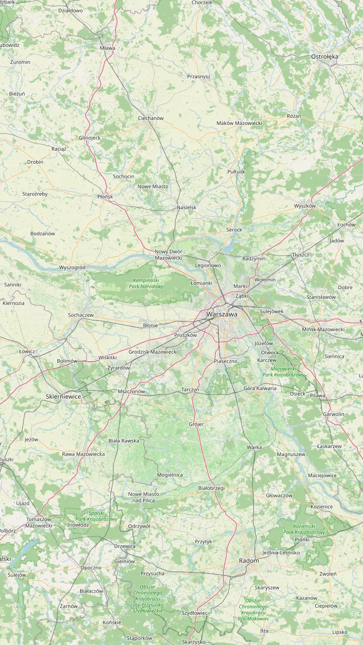
Choose a route, then tap a marker or stop for a note and Google Maps.
End of the Vistula Trail south and start of the Chojnów trail.
Google MapsSpa park with a 40-metre brine graduation tower, about 20 km from the center.
Google MapsWooden villas and former sanatoriums, about 20 km from the Palace of Culture.
Google MapsBeach, bathing area and water equipment rental on Zegrze Lake.
Google MapsWindsurfing base and sailing port 2 km on from Nieporęt.
Google MapsA citadel more than 2 kilometres long, over 40 km north-west of the center.
Google MapsRuins of the dukes' Gothic castle with a tower view over the Vistula valley.
Google MapsStart of the Kampinos Cycling Trail, reached from Młociny metro.
Google MapsMetro station for the ride to the Kampinos forest.
Google MapsChopin's birthplace, on the edge of the Kampinos forest.
Google MapsMemorial to Poles murdered in the forest in the Second World War.
Google MapsGlade with shelters, fire pits and an observation tower.
Google MapsStore that rents road and gravel bikes by the day.
Google MapsStart of the 56 km Zegrze Light ride along the Żerań Canal.
Google MapsStart of the ride east to the Mazovian Landscape Park.
Google Maps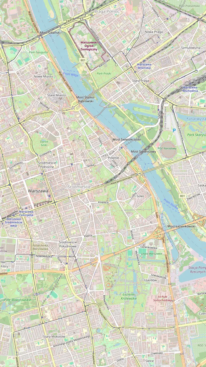
Start and finish of the city loop; on weekends from April to October the street running south from here closes to cars.
Google MapsWater, light and sound shows on Friday and Saturday evenings from May to September.
Google MapsThe 452-metre crossing for walkers and cyclists, the longest of its kind in Poland.
Google MapsA garden that climbs onto the library roof, open from spring to autumn.
Google MapsScience centre on the left-bank trail along the boulevards.
Google MapsThe largest beach on the Vistula, on the wild right bank.
Google MapsThe national stadium, lit white and red at night.
Google MapsMarina on the left bank; a new bridge over its canal was long awaited by cyclists.
Google MapsCross the river here on the special footbridge.
Google MapsNo cycling inside the gardens: lock up at a gate. Open 6.00 to 21.00, free.
Google MapsMeeting point of this site's 3-hour guided ride.
Google MapsMap data from © OpenStreetMap contributors
Road bike rental in Warsaw opens up a ring of day rides: a canal path to Zegrze Lake, the Kampinos forest on the city edge, spa towns to the south and a fortress to the north, often with a train home.
Editorial team, warsawbiketour.quest · Updated November 9, 2026 · 8 min reading time
The essentials
Warsaw sits in flat, green country cut by rivers, and the riding gets better the moment the suburbs end. Forests, reservoirs, castles and spa towns lie within a morning's pedal, and several rides finish at a railway station, which turns a long day into a one-way trip. The tourism office's advice is to allow at least a few hours for such a trip, or a whole day if you want to linger.7
The city has an unusual neighbour: it is the only European capital next to a national park.8 The Kampinos forest begins just beyond the north-western districts, close enough to reach from a metro station. To the north lies Zegrze Lake, to the south the Vistula valley with its orchards and a ruined castle, and to the east the sandy trails of the Mazovian Landscape Park.
This page sorts those rides by direction, with what each asks of you and how to get home. On the map, the day-rides panel pins the start points and destinations. For road and gravel bike rental in Warsaw, see the section further down: the right bike matters more out here than it does on the boulevards, where any city bike will do.
Rides compared
| Ride | Distance | Ground | Way back |
|---|---|---|---|
| Zegrze Lake | 56 km round trip9 | Flat asphalt, some gravel | Train from Nieporęt6 |
| Konstancin | About 20 km out3 | River trail and roads | Ride back |
| Czersk castle | Over 40 km out19 | Valley roads and orchards | Ride back |
| Modlin Fortress | Over 40 km out22 | Roads north-west | Ride back |
| Mazovian Landscape Park | 50 km there and back23 | Forest sand | Suburban train24 |
| Kampinos half day | 32 km loop25 | Forest tracks | Metro from Młociny |
Distances as the Warsaw Tourism Office and the Warsaw by Bike shop publish them, measured from the Palace of Culture and Science or as round trips.3,9
The gentlest ride out follows the river. The Vistula Trail continues south past the royal residences of Łazienki and Wilanów and ends at Powsin Park.13 Wilanów district still has a lot of farmland, and the tourism office calls its bicycle route among the fields one of the most tranquil in the city.14 A short detour to the embankment leads through riverside meadows to Wilanów Zawady, a long sandy beach on the Vistula.15
From Powsin, the Chojnów Bicycle Trail runs on forest paths and quiet asphalt via the Kabacki Forest as far as the Chojnów Landscape Park.16 Halfway, the Zimne Doły glade has shelters, fire pits and an observation tower for watching birds on the ponds.17 Konstancin-Jeziorna lies about 20 km from the Palace of Culture and Science, just over an hour by bike.3 Its spa park has a 40-metre brine graduation tower, where the salty air is the point of the visit.18
For a longer day, push on to Czersk, more than 40 km south of the center, where the Gothic castle of the Masovian dukes stands in ruins above the valley.19 Climb its tower for a view over the Vistula valley and the orchards around it.20 On the east side of the river, Otwock, about 20 km out, keeps dozens of wooden villas and former sanatoriums in a pine forest.4 Its Veturilo stations link with the city system.21
Weather by month
Mid-month hours with no sun, and days when precipitation reaches 2.5 mm or above. Source: NOAA, station Warsaw-Okecie (rainfall) and Siedlce (temperatures), 1991 to 2020.69
Zegrze Lake, the reservoir locals call the Warsaw Sea, is the biggest in the Warsaw area.32 It lies about 35 km from the Palace of Culture and Science, reached by following the Żerań Canal.1 The Warsaw by Bike shop publishes the ride as a 56 km round trip from the Radosław Roundabout that takes 5 hours or more.9 The surface is flat asphalt with some gravel, kept apart from car traffic, and suits any bike, trailers included.26
The canal path is a nature ride as much as a commute. Herons, wild ducks and beavers live along the water.10 At Nieporęt a beach with a bathing area, a children's paddling pool and water equipment rental waits at the end.11 Windsurfers ride 2 km further to Białobrzegi, with its windsurfing base and a port full of sailing boats.12 And if your legs give up, a train from Nieporęt station returns to central Warsaw in under 40 minutes.6
Modlin is the north-western counterpart, more than 40 km from the Palace of Culture and Science.22 The reward is a fortress whose hexagonal citadel building runs for more than 2 kilometres.33 Ride around it or climb the lookout tower, and look out for the story of a tame polar bear brought there by Polish soldiers. It is a full day, and the riverside towns on the way make good lunch stops.
Which ride?
Match the ride to your legs, your bike and your time.
If I want flat and easy with a swim
Zegrze Lake
The canal path is flat, away from cars, and ends at a beach.26,11
If I want real forest
Kampinos, in stages
Split the trail into stages to enjoy the forest and its sights.28
If I have only half a day
Konstancin or Otwock
If I am with small children
The yellow Wawer trail
It is the one the tourism office suggests for small children.29
If I want a hard workout
The black trail or Wieliszew
Dunes and climbs on the black trail, 200 metres of climbing at Wieliszew.30,31
Pick a direction
Easy and flat
North along the canal
See this ride
Wild and sandy
North-west from Młociny
See this ride
A long day
South down the valley
See this rideThe Kampinos Cycling Trail is the big one. Its start, the Glade of Honorary Blood Donors by the Opaleń clearing, is easiest to reach from the Młociny metro station, riding towards Wólka Węglowa.46 The trail runs for over 144 km and makes an intense 10-hour marathon on good mountain bikes for very fit riders.2 It is marked in green, on forest paths, asphalt and dirt roads, and is sandy or marshy in places.27
Most riders do a slice of it. The tourism office suggests splitting the trip into stages if nature and local sights matter more than distance.28 The forest holds 200 km of cycle paths in all.54 The rental shop's half-day Kampinos MTB and gravel loop is 32 km and takes 3 to 5 hours.25 Its full loop is 147 km and 8.5 hours, a day for experienced riders only.55
Some stops give the ride its meaning. Żelazowa Wola, on the forest's edge, is the birthplace of Fryderyk Chopin, and the Palmiry Memorial remembers the Poles murdered in the forest in the Second World War.47 Treat Palmiry as a place of mourning, not a picnic stop. Pack insect repellent too: the forest is said to hold 31 species of mosquitoes.51
Short of time?
No time for a day out? These rides include the bike.
Choose from 3 options
No time for a day out? These rides include the bike.
≈
View≈
View≈
ViewAll amounts are from-prices on GetYourGuide, converted at the ECB reference rate. Exact prices are shown at booking.
A day at the lake
Morning
The published route starts here and heads north.9
Along the canal
Watch for herons, ducks and beaver marks.10
Midday
Beach, bathing area and water equipment rental.11
Afternoon
Białobrzegi is 2 km further on.12
Late afternoon
A train from Nieporęt is under 40 minutes to the center.6
East of the river, a route of about 50 km there and back leads from the Siekierkowski Bridge through Anin to the Mazovian Landscape Park.23 Allow around 3 hours.56 Here the Vistula's tributaries still run wild, and the winding Świder river gives the area its charm. The park's Wawer trails are 8 routes of different difficulty, and the blue one is nicknamed the Butcher for its sandy stretches.57
Families have choices too. The yellow Wawer trail suits small children, while older children cope with the green and red ones.29 The trail ends lie close to transport, and a tired family can return to Warsaw by suburban train.24 On sand, wide tyres help more than gears, and a trekking or mountain bike beats a city bike with narrow wheels.
Strong riders will find the area's toughest ground here. A black mountain bike trail in the same park runs 27 km through dunes, wetlands and hills.30 Its height differences reach 22 metres.58 North of the city, the Wieliszew Cross Route is about 12.5 km long with over 200 metres of climbing, and the route record, set by the road cyclist Cezary Zamana, is 31 minutes 54 seconds.31,59
Video
Ato Cycling on YouTube · Video data is requested only when you tap play.
If you prefer to enjoy nature and visit local attractions, divide the trip into stages.
Day ride checklist
For the long flat runs to Zegrze or Czersk, a road or gravel bike makes the day quicker. Decathlon Rent lists a road bike at its Targówek store for 70 PLN a day.5 Its Reduta store also rents road bikes at 70 PLN a day.60 For gravel riding, the Targówek store lists a gravel bike at 95 PLN a day.48 The service can also deliver equipment to an address in Poland.61
The central rental shop at Stawki is still adding road and gravel bikes to its fleet.62,63 Mountain bikes there cost from PLN 99 a day and trekking bikes PLN 60 a day, both sound choices for forest sand.64,65 With an electric bike, at PLN 120 a day or more, Kampinos becomes realistic for riders who do not train.66 Book ahead for summer weekends to be sure of a Warsaw road bike rental.
Trains are the secret of good day rides. On Koleje Mazowieckie trains a bike rides in the first or last vestibule or in a spot marked with a bike pictogram, unless the train is very full.52 SKM and KM doors with bike space carry special pictograms.67 Inside the city, metro, trams and buses carry bikes outside rush hours, and the tourism office asks riders to use them for emergencies rather than everyday trips.68,53 Check the train fare for the bike before you set off.
The riding season follows the weather. The figures here pair rainfall from the Warsaw-Okecie station, 7.7 km from the center, with temperatures from the Siedlce station, 84.3 km east.69 In May, highs average 19.4 °C, and the mid-month sun stays up for 15.7 hrs.69 By July they reach 24.9 °C, with 75 mm of rain in the month.69 A waterproof layer earns its place in the pannier through the summer months.
September is a fine month for long rides: highs average 18.7 °C and the rain eases to 46 mm.69 The forests turn gold in October, when highs average 12.5 °C.69 Early spring is cool and the forest tracks can stay wet, while from November the days are short and cold. The Veturilo city bikes, a handy add-on for the city legs of a ride, run from 1 March to 30 November.70
Whatever the month, start early. Light is the limit on long rides, and a morning departure leaves time for a swim at Zegrze or a slow lunch in Konstancin. Pack lights anyway: a front and rear set is required when visibility is poor.49 If the weather turns, the trains are your friend, and that is the main reason to plan rides with a station at the far end.
FAQ
It lies about 35 km from the Palace of Culture and Science along the Żerań Canal.1
On Koleje Mazowieckie trains it goes in the first or last vestibule or a marked spot.52
It is flat asphalt with some gravel, away from cars, and suits trailers.26
Ride from the station towards Wólka Węglowa to the trail start at the Opaleń clearing.46
Sources
Cycling Warsaw soon? Ask a real person here.